Catalog Archive
Auction 121, Lot 394

"Carta particolare della Brasilia, che comincia con il Capo S. Antonio et finisce con il Porto del Spirito Sancto…", Dudley, Robert (Sir)
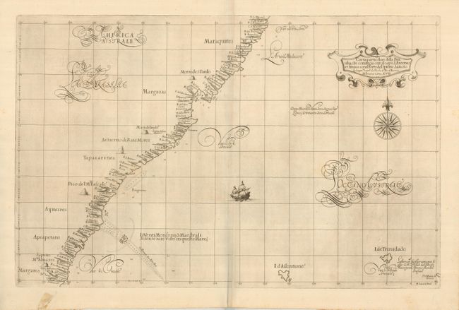
Subject: Brazil

Period: 1647 (published)

Publication: Dell Arcano del Mare

Color: Black & White

Size:
29.5 x 18.8 inches
74.9 x 47.8 cm
Download High Resolution Image
(or just click on image to launch the Zoom viewer)

This striking sea chart of Brazil's eastern coast is from the first atlas to print all maps on Mercator's projection, the first to show winds, currents and magnetic deviation on its maps, and the first atlas of sea charts by an Englishman. The map covers the coast from Sao Miguel dos Campos, past Todos os Santos Bay to Salvador and Linares. Dudley, a skilled mathematician and navigator, was exiled from England and settled in Florence where his atlas was published. The chart, beautifully engraved by Antonio Lucini, is embellished with a title cartouche, large compass rose, two sailing ships and graceful calligraphy. Two sheets, joined, as issued.

References:

Condition: A

Superb impression on fine, strong paper. There is a small repaired tear in the lower margin with a faint stain, not affecting the map.

Estimate: $1,500 - $2,000

Sold for: $1,000

Closed on 9/26/2007

Archived