Catalog Archive
Auction 121, Lot 375

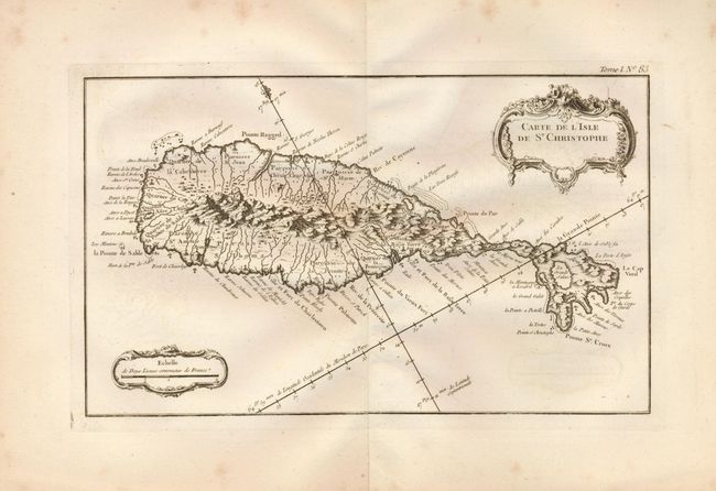
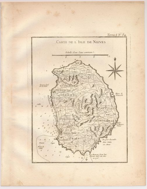
"[Lot of 2] Carte de l'Isle de St. Christophe [and] Carte de l'Isle de Nieves", Bellin, Jacques Nicolas

Subject: St. Kitts and Nieves

Period: 1764 (circa)

Publication: Le Petit Atlas Maritime

Color: Black & White

Size:
See Description
Download High Resolution Image
(or just click on image to launch the Zoom viewer)

A nice pair of maps that together show the entire federation St. Kitts & Neves. The former, Carte de l'Isle de St. Christope is an attractive, crisply engraved map that features two rococo-style cartouches, rhumb lines and a fleur-de-lys. Great detail of the mountains, rivers and anchorages. 13.3 x 8".

The latter, Carte de l'Isle de Nieves, is a handsome, detailed map of Nevis in the Leeward Islands of the West Indies. Nevis is a part of present-day St. Kitts-Nevis, an Associated State in the British Commonwealth. The map details the topography, names the parishes, and shows the roads, towns, soundings, and anchorages. Compass rose with fleur-de-lys and distance scale. 6.3 x 8.3".

References: Phillips (A) #3508, v.1-84; Sellers & Van Ee #1995; Tooley (MCC-81) St. Kitts #33 & #39.

Condition: B

Both maps have some foxing, mostly in margins. Map of St. Christophe has some faint offsetting, and map of Nieves has a minor printer's flaw resulting in a thin, unprinted strip down the center.

Estimate: $180 - $240

Sold for: $120

Closed on 9/26/2007

Archived