Catalog Archive
Auction 121, Lot 367

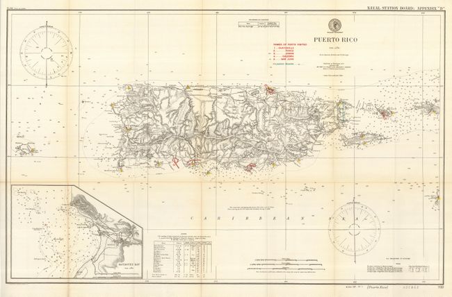
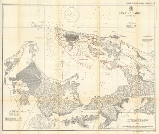
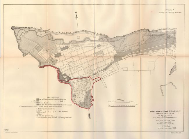
"[Lot of 3] Puerto Rico from Spanish British and U.S. Surveys, San Juan Harbor Puerto Rico [and] San Juan Porto-Rico Limits of Lands to be Retained by the War and Navy Departments in the Island of San Juan", U.S. War Department

Subject: Puerto Rico

Period: 1899-1901 (dated)

Publication: HR Doc. #139, 57th Congress, 1st Session

Color: Printed Color

Size:
See Description
Download High Resolution Image
(or just click on image to launch the Zoom viewer)

Set of related maps and the report detailing the plan to establish a Naval Station in Puerto Rico. In late 1898 the Treaty of Paris ended the Spanish-American War. One of the provisions of the treaty ceded Puerto Rico to the United States. These maps detail the effort to establish and maintain America's military and naval presence in the region. The mostly black & white maps have occasional colored overprinting to highlight features. The first two maps are by the Coast and Geodetic Survey. Set includes:

1) "Puerto Rico" 1899 (20.8 x 33"). With an inset of Mayaguez Bay, lighthouses indicated by color. Table gives location and signature of 18 lighthouses. 2) "San Juan Harbor Puerto Rico" 1900 (32 x 38.8"). Large and very detailed chart using color to indicate several areas under consideration for the naval station. 3) "San Juan Porto-Rico Limits of Lands to be Retained by the War and Navy Departments" 1901 (13.5 x 19.3"). Shows the old fort at the tip of San Juan.

References:

Condition: A

Clean and bright examples with some small spots and faint toning, else fine.

Estimate: $100 - $140

Sold for: $170

Closed on 9/26/2007

Archived