Catalog Archive
Auction 121, Lot 295

"A Plan of the City and Environs of Philadelphia…", Scull and Heap/Lotter

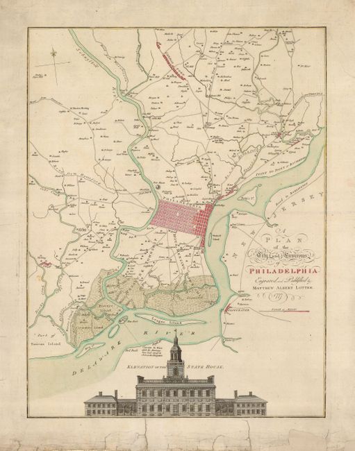
Subject: Pennsylvania, Philadelphia

Period: 1777 (dated)

Publication:

Color: Hand Color

Size:
18 x 23.5 inches
45.7 x 59.7 cm
Download High Resolution Image
(or just click on image to launch the Zoom viewer)

This important, Revolutionary War era map of Philadelphia, initially issued by Nicolas Scull and George Heap in 1752, was published by Matthias Albrecht Lotter under an Anglicized version of his name. The original Scull & Heap plan was made for use as a tool to promote settlement to the early city. This updated version was issued by Lotter in response to demand for information about the region that was the center of the American Revolution. The map shows the early grid of the city, extending to the outlying areas, including Germantown and Derby with individual farms noted throughout. A handsome engraving of Independence Hall is shown at the bottom of the map under the title of its former name: "Elevation of the State House."

References: Nebenzahl (REV) #131.

Condition: B

A sharp impression on a sheet that has been backed with acid-free paper to repair some marginal weakness, paper loss and tears, with just one tear entering the map about 1/2 inch at bottom.

Estimate: $3,000 - $3,500

Unsold

Closed on 9/26/2007

Archived