Catalog Archive
Auction 121, Lot 274
"Geological Map of Long & Staten Islands with the Environs of New York", Mather, W. W.
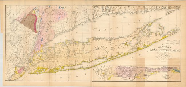
Subject: New York, Long Island
Period: 1842 (dated)
Publication: Geology of New York, Volume I
Color: Hand Color
Size:
51 x 22.3 inches
129.5 x 56.6 cm
Download High Resolution Image
(or just click on image to launch the Zoom viewer)
(or just click on image to launch the Zoom viewer)