Catalog Archive
Auction 121, Lot 26

"A New & Correct Chart of all the Known World Laid Down According to Mercator's Projection…", Bowen, Emanuel
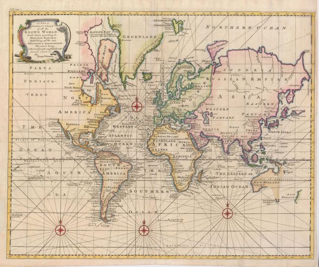
Subject: World

Period: 1744 (circa)

Publication: Navigantium atque Intinerantium: Or, A Compleat Collection of Voyages…

Color: Hand Color

Size:
17.8 x 14.3 inches
45.2 x 36.3 cm
Download High Resolution Image
(or just click on image to launch the Zoom viewer)

This attractive sea chart is filled with rhumb lines and compass roses. The northwest coast of North America is left blank and noted as Parts Undiscovered. Australia is misshapen and connected to Van Diemens Land with indistinct eastern and southern coastlines. New Zealand is mapped only on the west coast with no evidence of two islands. Near Japan, an odd piece of coastline is named as De Gama's Land with a small island nearby claimed as Company's Land.

References:

Condition: B+

Issued folding, now flattened. A nice impression with attractive color on a sheet with a repaired margin on the left, and one short tear in the lower margin. The centerfold is lightly toned, and has been reinforced on the verso, as have a couple folds.

Estimate: $450 - $500

Sold for: $450

Closed on 9/26/2007

Archived