Catalog Archive
Auction 121, Lot 262

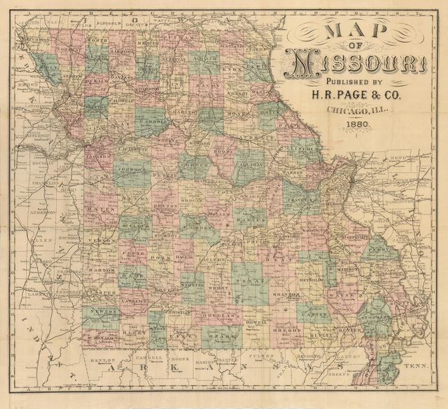
"Map of Missouri", Page, H. R.

Subject: Missouri

Period: 1880 (dated)

Publication:

Color: Hand Color

Size:
20.5 x 18.5 inches
52.1 x 47 cm
Download High Resolution Image
(or just click on image to launch the Zoom viewer)

This scarce folding pocket map shows approximately 114 counties in full original hand coloring. The highly detailed map locates cities, towns, rivers, lakes, marshes, roads and railway lines. The 22-page index lists cities and counties, and numerous railroads with their stations and distances. Map folds into its original tan paper wrappers that measure 3.6 x 6". The title is printed in black and has decorative flourishes in red on the front and back. A rarely seen issue.

References:

Condition: A

Map has a faint stain from watercolor running at edge of map, just below title. Booklet hinges are starting to crack, and the first couple of pages have scattered foxing. Covers are a bit sunned or soiled and slightly abraded on edges.

Estimate: $400 - $600

Unsold

Closed on 9/26/2007

Archived