Catalog Archive
Auction 121, Lot 260

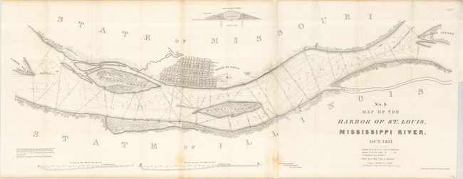
"No. 3 Map of the Harbor of St. Louis, Mississippi River", U.S. Army

Subject: Missouri

Period: 1837 (dated)

Publication: Senate Doc. #139, 25th Congress, 2nd Session

Color: Black & White

Size:
42 x 16.6 inches
106.7 x 42.2 cm
Download High Resolution Image
(or just click on image to launch the Zoom viewer)

Robert E. Lee surveyed and produced three maps of the Mississippi River in 1837. This one covers that portion of the river in the vicinity of St. Louis and includes a street plat of the city (with some streets named). It locates stone quarries, lime kilns, Indian mounds, etc. The islands of Cascarot (partial), Bloody, Duncan's and part of Cahoe are shown. There are proposed dikes and revetments to improve the harbor. A cross-section of a typical dyke is illustrated. Finely drawn by Lee, it contains minute detail of the area.

References: Koepp #316.

Condition: B+

Map is joined and backed with archival tissue. The map has a couple spots.

Estimate: $140 - $180

Sold for: $130

Closed on 9/26/2007

Archived