Catalog Archive
Auction 121, Lot 175

"Carte de la Virginie et du Maryland Dressee sur la Grande Carte Angloise de Mrs. Josue Fry et Pierre Jefferson…", Robert de Vaugondy, Didier

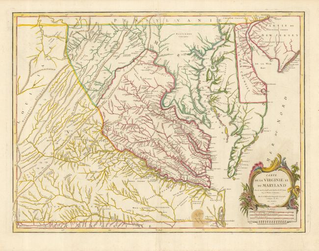
Subject: Colonial Mid-Atlantic

Period: 1755 (dated)

Publication: Atlas Universel

Color: Hand Color

Size:
25 x 19 inches
63.5 x 48.3 cm
Download High Resolution Image
(or just click on image to launch the Zoom viewer)

This handsome map is Didier Robert de Vaugondy's edition of the Fry-Jefferson map of the same date entitled A Map of the most Inhabited part of Virginia. It details the region from Cape May in New Jersey to the Currituck Inlet and inland with finely engraved details of the interior regions of Virginia, the ridges and valleys of the Appalachians, and the Chesapeake and Delaware Bays. The locations of native camps and wagon roads are noted as well. Delaware is labeled as De La War Counties. Peter Jefferson was Thomas Jefferson's father, and Joshua Fry was a commander in the colonial militia during the French and Indian War. This is the third state of the map, published circa 1778.

References: cf Cumming (SE) #281; Pedley #470; Phillips, (VA) pp. 49.

Condition: A

Superb impression and nice color. Marginal centerfold reinforced on verso at bottom, and a couple minor printer's creases, also in margin.

Estimate: $3,500 - $4,500

Unsold

Closed on 9/26/2007

Archived