Catalog Archive
Auction 121, Lot 160

"Theil der Vereinigten Staaten von Nord America", Weld, Isaac

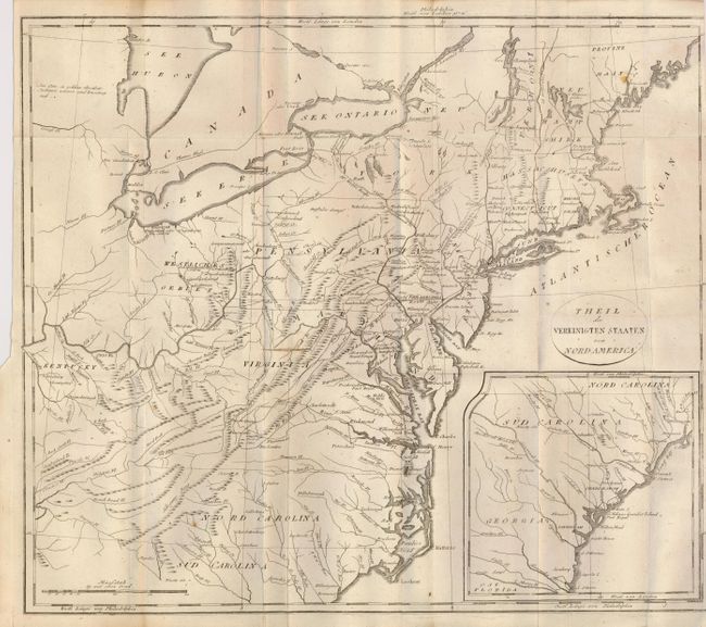
Subject: United States - Eastern

Period: 1805 (circa)

Publication: Reise durch die Staaten von Nordamerika

Color: Black & White

Size:
18.3 x 15.8 inches
46.5 x 40.1 cm
Download High Resolution Image
(or just click on image to launch the Zoom viewer)

This German edition of Stockdale's map extends from Maine to South Carolina and westward to include Kentucky, but not to the Mississippi River. With many place names, it includes small villages in the frontier and names Toronto, Detroit, Leestown, Lexington, Boonsborough and the historical settlement of Ninety Six in South Carolina. Established in the early 1700's, this settlement was named from the mistaken belief that it was 96 miles from the nearest Cherokee village of Keowee. Ninety Six figured prominently in the Anglo-Cherokee War and also in the Southern Campaign of the American Revolution. In fact, the first land battle of the American Revolutionary War south of New England was fought here in 1775. The map also locates the Dismal Swamp, numerous trails and roads, and more. The same scale continues in an inset of the Carolinas and Georgia, south to the St. Marys River. The title is contained in a simple oval cartouche.

References: McCorkle 800.4.

Condition: B

Dark impression on thick hand laid paper with original margins. Binding trim at left margin. Small area of paper cut about 1" long with 1/16" missing, barely affecting map image.

Estimate: $180 - $240

Sold for: $100

Closed on 9/26/2007

Archived