Catalog Archive
Auction 121, Lot 159

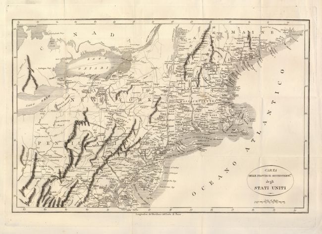
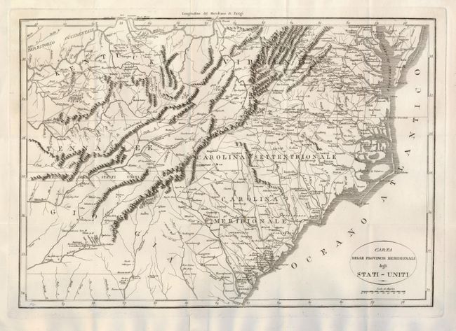
"[Lot of 2] Carta Delle Provincie Settentrionli. degli Stati Uniti [Together with] Carte Delle Provincie Meridionali degli Stati-Uniti", Rochefoucald Liancourt, Francois Alexander

Subject: United States - Eastern

Period: 1793 (circa)

Publication:

Color: Black & White

Size:
19 x 12.5 inches
48.3 x 31.8 cm
Download High Resolution Image
(or just click on image to launch the Zoom viewer)

An uncommon and crisply engraved pair of maps describe the young United States. The northern map extends from the Passamaquoddy Bay in Maine down to Delaware and west to Lake Erie. The southern sheet is from the Chesapeake Bay to Savannah, Georgia and west to Tennessee, covering Kentucky, Virginia, Tennessee, North and South Carolina and part of Georgia. These maps provide a nice view of early settlements and roads, as well as the mountains and forests. Between Tennessee and Georgia is a long strip of land labeled Territorio degli Stati Uniti. This land originally belonged to South Carolina but was ceded back to the United States in 1787, subject to Indian occupancy. Numerous Indian villages are shown, especially in the region of present-day Alabama.

These maps are from either an Italian edition of Francois la Rochefouchauld Liancourt's Travels through the United States of North America… or Carlo Botta's Storia della Guerra dell' Independenza Degli Stati Uniti d'America. Howes does not list an Italian edition of La Rochefouchauld Liancourt's book, but these are copied from his map.

References:

Condition: A

Very sharp impression on a strong sheet with folds as issued. There are a couple of insignificant spots of foxing. Two holes in right margin away from map on the southern sheet.

Estimate: $600 - $700

Sold for: $450

Closed on 9/26/2007

Archived