Catalog Archive
Auction 121, Lot 100

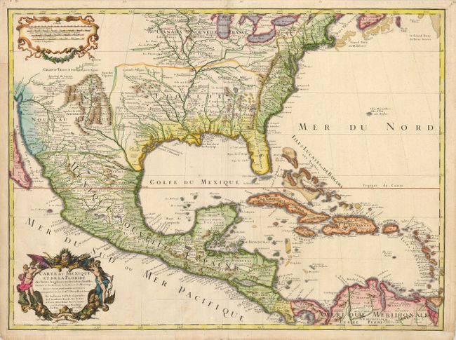
"Carte du Mexique et de la Floride des Terres Angloises et des Isles Antilles du Cours et des Environs de la Riviere de Mississipi…", Delisle, Guillaume

Subject: Colonial North America and Caribbean

Period: 1703 (dated)

Publication:

Color: Hand Color

Size:
25.3 x 18.8 inches
64.3 x 47.8 cm
Download High Resolution Image
(or just click on image to launch the Zoom viewer)

This is the uncommon first edition of Delisle's important map of the region with the Rue des Canettes address. This map is credited with accurately showing the course of the Mississippi River and its mouth for the first time. The map influenced later delineations of the Mississippi River by Seutter, Homann, Lotter and others for many years. It is an attractive map that includes much of the present day United States, Mexico, Central America, and the Caribbean. The British colonies are confined along the Eastern Seaboard. Florida is shown as a Spanish possession taking in the entire southern region and the Southwest is labeled Nouveau Mexique

References: Tooley (AMER) #48, pp. 22; Cumming #137; Wheat pp 58-61; Wagner #474; Schwartz & Ehrenberg pl. 82

Condition: B+

A dark impression with later color on a sheet with margins that have been trimmed a little, but are still sufficient for framing. The left and lower margins and an extraneous fold have old paper reinforcements on verso.

Estimate: $4,500 - $6,000

Sold for: $2,500

Closed on 9/26/2007

Archived