Catalog Archive
Auction 120, Lot 705

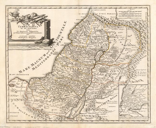
"Terra Sancta in XII Olim Tribus nunc VI Provincias dispertita…", Weigel, Christopher

Subject: Holy Land

Period: 1724 (circa)

Publication:

Color: Black & White

Size:
15.8 x 12.8 inches
40.1 x 32.5 cm
Download High Resolution Image
(or just click on image to launch the Zoom viewer)

Handsome and uncommon map of the Holy Land based on Sanson showing both the divisions of Twelve Tribes of Israel and the Roman political divisions on both sides of the Jordan River. The map shows the Mediterranean coastline from Sidon to Gaza, with a large inset in the lower right detailing the Exodus from Egypt. The decorative cartouche is a cloth-draped altar topped with a crown, scrolls, a compass, and other items.

References: Laor #829.

Condition: B

The map has a nice, dark impression. There is some professional and nearly invisible repairs of a couple tears in the lower margin and the right neat line, and the map is backed with light Japanese tissue.

Estimate: $230 - $300

Sold for: $160

Closed on 7/18/2007

Archived