Catalog Archive
Auction 120, Lot 413

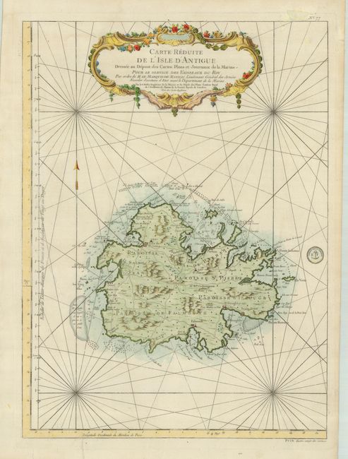
"Carte Reduite de l'Isle d'Antigue dressee au Depost des Cartes Plans et Journaux de la Marine…", Bellin, Jacques Nicolas
Subject: Antigua

Period: 1758 (dated)

Publication: Hydrographie Francoise

Color: Hand Color

Size:
16.3 x 22.3 inches
41.4 x 56.6 cm
Download High Resolution Image
(or just click on image to launch the Zoom viewer)

Fine, large-scale map of Antigua provides detailed information on the roads, topography, parishes, towns, settlements, soundings and anchorages. It is decorated with a large, floral-garland draped title cartouche and rhumb lines. Seal of the Depot de la Marine in map and Prix. Quatre-vingt-dix centimes at bottom right.

References:

Condition: B

Strong impression printed on sturdy paper. There are some repaired tears in the margins and one in the blank part of the map off the western shoreline.

Estimate: $400 - $450

Sold for: $600

Closed on 7/18/2007

Archived