Catalog Archive
Auction 120, Lot 319
"Chart and Plan of the Harbour of New York & the County Adjacent, from Sandy Hook to Kingsbridge, Comprehending the Whole of New York and Staten Islands, and Part of Long Island & the Jersey Shore: and Shewing the Defences of New York Both by Land and Sea", Lodge, John
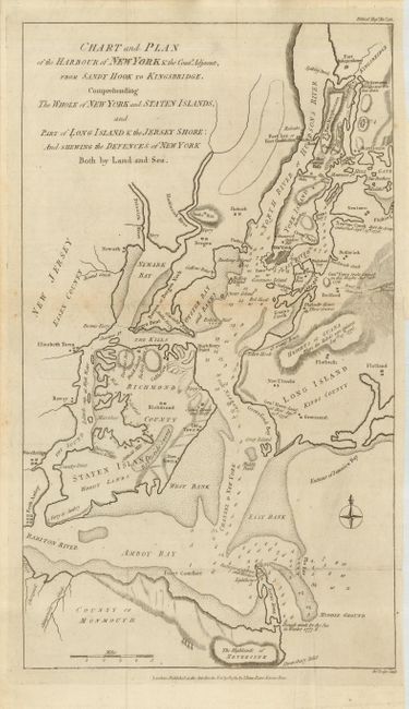
Subject: New York
Period: 1781 (dated)
Publication: Political Magazine
Color: Black & White
Size:
9.5 x 16.5 inches
24.1 x 41.9 cm
Download High Resolution Image
(or just click on image to launch the Zoom viewer)
(or just click on image to launch the Zoom viewer)