Catalog Archive
Auction 120, Lot 284

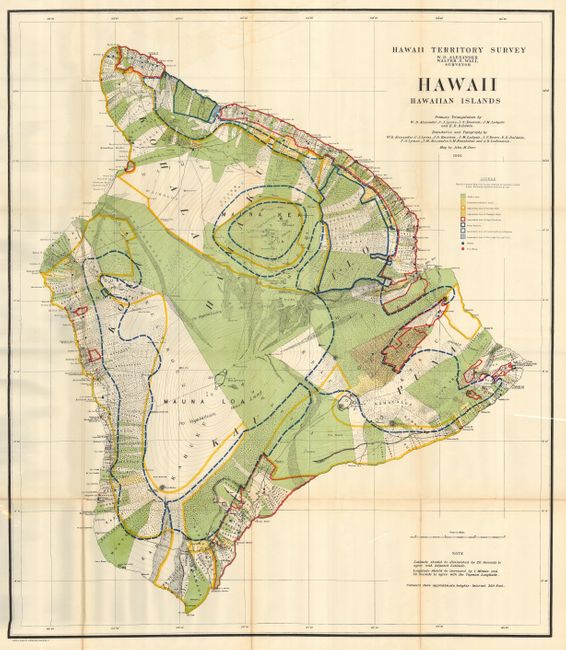
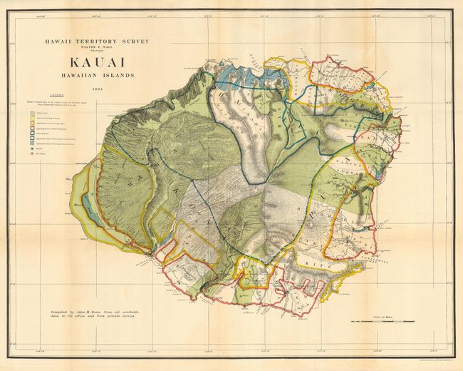
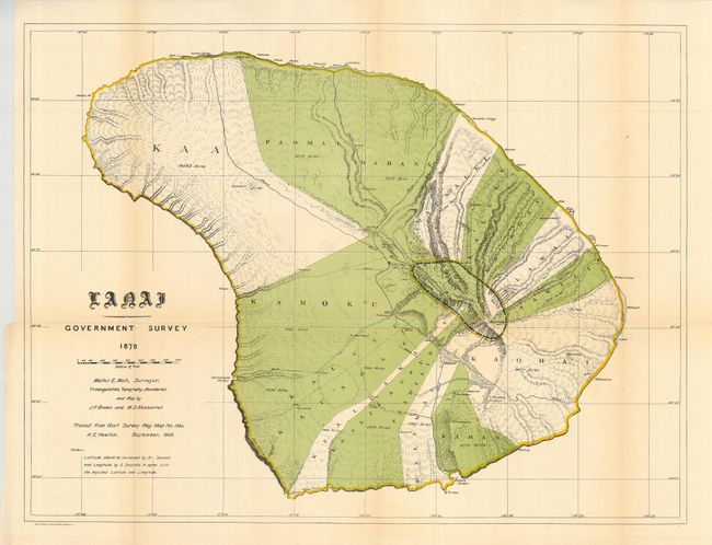
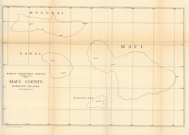
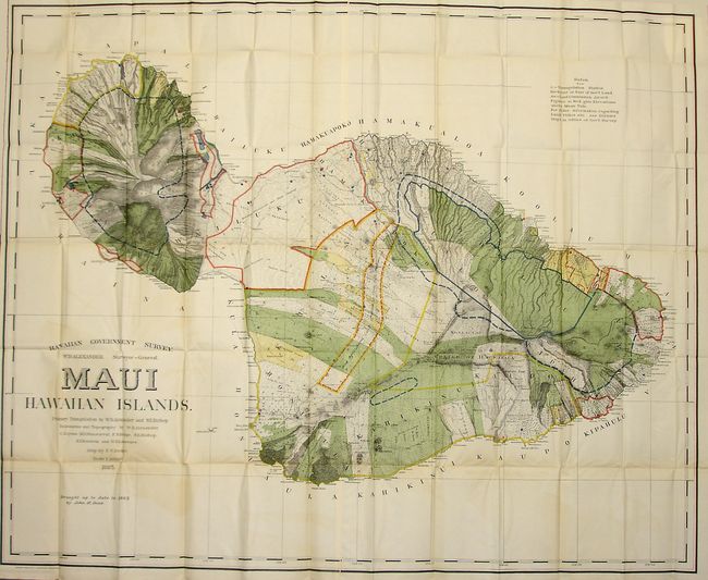
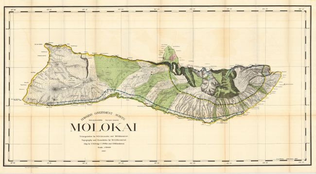
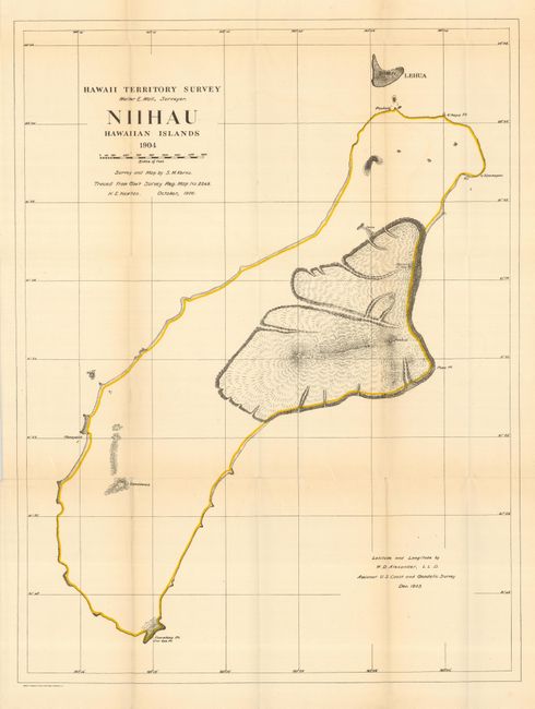
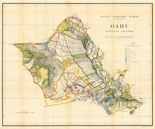
"[Lot of 8 - Hawaii]", U.S. Government

Subject: Hawaii

Period: 1897-1906 (dated)

Publication:

Color: Printed Color

Size:
See Description
Download High Resolution Image
(or just click on image to launch the Zoom viewer)

A terrific collection of maps of the Hawaii Territory as surveyed by W.D. Alexander and Walter E. Wall. Each is filled with colorful details including the location of Public Lands, Homestead Settlement Tracts, Grazing Lands, Pineapple Lands, Sugar Plantations, Forest Reserves, Forest Lands, Wet Lands, and more. The maps are stamped on verso 1 through 9 with number 2 not present. Lot includes the following maps:
1) Hawaii Hawaiian Islands. 1901 (31.5 x 36")
2) Kauai Hawaiian Islands. 1903 (30 x 23.4")
3) Lanai Government Survey 1878 / 1906. (26 x 19.6")
4) Maui County Hawaiian Islands. Simple black and white outline. (16.7 x 11")
5) Hawaiian Government Survey. W.D. Alexander Surveyor-General. Maui Hawaiian Islands. 1895 / 1903 (52 x 43.5") A spectacular chart originally drawn in 1885, updated to 1903. With a little fold toning in blank areas.
6) Hawaiian Government Survey. W.D. Alexander Surveyor-General. Molokai 1897. (48 x 25") Beautifully colored.
7) Niihau Hawaiian Islands. 1904 / 1906 (19 x 25.3") Colored chart but with little detail outside of the detailed lava flows surrounding Puulua, Kaeo, Paniau and Pualae.
8) Oahu Hawaiian Islands. 1902. (33 x 27") A most detailed and spectacularly colored chart of the island.

A remarkable collection of maps we've not seen offered together.

References:

Condition: A

All folding, as issued. Each features bright color (except #4) and full margins. An occasional fold line with toning and/or short splits.

Estimate: $1,200 - $1,500

Sold for: $900

Closed on 7/18/2007

Archived