Catalog Archive
Auction 120, Lot 267

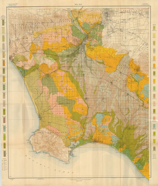
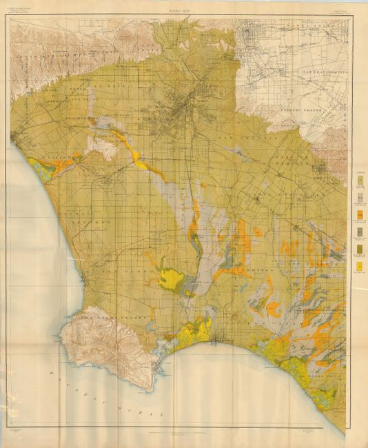
"[Lot of 2] Soil Map California Los Angeles Sheet [and] Alkali Map California Los Angeles Sheet", U.S. Geological Survey (USGS)

Subject: Los Angeles, California

Period: 1903 (dated)

Publication:

Color: Printed Color

Size:
29.5 x 34.3 inches
74.9 x 87.1 cm
Download High Resolution Image
(or just click on image to launch the Zoom viewer)

Great pair of matching maps drawn on the same base map. The area covers the Los Angeles Basin to include parts of Los Angeles and Orange counties. The maps shows the cities and roads between the Santa Monica Mountains, Santa Anita, La Bolsa Chica (today's Huntington Beach), and Los Palos Verde, the site of today's Rancho Palos Verde. It is interesting to note the cities and towns that are not on the map. Excellent detail of the rapidly growing region on a scale of 1 mile to the inch. Both are beautifully colored to match their respective legends. The soil map lists 34 different soil types, each with its unique color and pattern. The alkali map indicates six different degrees of alkalinity, again via color and pattern. A pair of large and most detailed maps of the Los Angeles area.

References:

Condition: B+

Very fine coloring, bright and sharp. One or two spots on each and a few fold intersection splits.

Estimate: $100 - $140

Sold for: $275

Closed on 7/18/2007

Archived