Catalog Archive
Auction 120, Lot 172

"Carte de la Louisiane et du Cours du Mississipi Dressee sur un Grand Nombre de Memoires entrautres sur ceux de Mr. le Maire", Delisle/Covens & Mortier

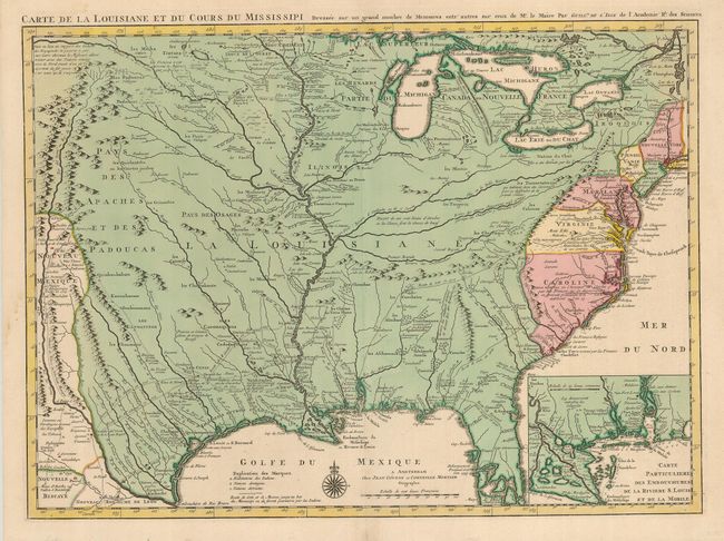
Subject: Colonial United States

Period: 1730 (circa)

Publication: Atlas Nouveau, Contenant Toutes les Parties du Monde

Color: Hand Color

Size:
23.5 x 17.3 inches
59.7 x 43.9 cm
Download High Resolution Image
(or just click on image to launch the Zoom viewer)

This is the updated version of Delisle's influential map of the French possession of Louisiana that drew together the cartographic work of the previous half century and had a tremendous impact on the history of cartography. When originally published in 1718, it was the first detailed map of the Gulf region and the Mississippi, and the first to show the explorations of De Soto, Cavelier, Tonty, Moscoso and Denis. The name Texas made its first appearance in print on this map, with the legendary Mission de los Teijas, established in 1716. An inset of the Mississippi delta and Mobile Bay fills the lower right corner. This is the Covens & Mortier issue, updated to include the newly founded settlement of New Orleans.

References: Cumming (SE) #208; Tooley (Amer) p.22, #45; cf. Wheat (TMW) #99; cf. Martin & Martin #19.

Condition: A

Fine impression and original color. Margins trimmed but still ample.

Estimate: $2,500 - $3,000

Sold for: $5,000

Closed on 7/18/2007

Archived