Catalog Archive
Auction 120, Lot 148

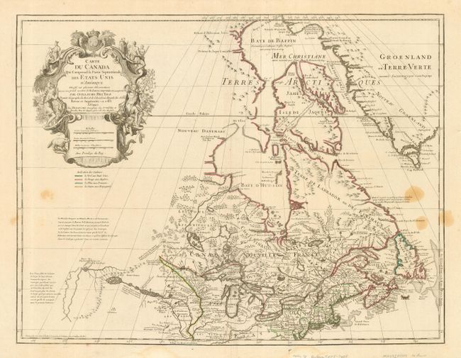
"Carte du Canada qui Comprend la Partie Septentrionale des Etats Unis…", Delisle/Dezauche

Subject: United States & Canada

Period: 1783 (dated)

Publication: Atlas Geographique des Quarte Parties du Monde

Color: Hand Color

Size:
25.3 x 19.5 inches
64.3 x 49.5 cm
Download High Resolution Image
(or just click on image to launch the Zoom viewer)

First issued by Guillaume Delisle in 1703, this richly detailed map provides the most accurate rendering of the Great Lakes of the time, with the lakes fully enclosed and properly placed in longitude and latitude. Delisle's map of Canada and the Great Lakes is one of the most outstanding and influential maps of the eighteenth century. It correctly positions the Ohio River but confuses its name with the Wabash River. West of the Mississippi Lahontan's fictitious Riviere Longue is prominently depicted. In Canada special attention is given to the rivers and lakes between Hudson Bay and the St. Lawrence, and Lac de Assenipoils (Lake Winnipeg) connects to Hudson Bay. Sanson's three islands of the Arctic are retained. The exquisite cartouche is decorated with a beaver, natives (one of whom is bearing a scalp), Jesuit explorers and centered with the French crown and coat of arms, which was removed in editions that were issued after the French Revolution. This is the eighth state of the map, issued by Dezauche, and noting the new United States in its title with a color code below the cartouche.

References: Kershaw # 315; Tooley (Amer) #42, pp 20.

Condition: B

The map has original outline color and good, wide margins. There are four stains on the right, lightly mirrored on left and faint damp stains in the lower margin, just touching the neatline.

Estimate: $800 - $1,100

Sold for: $500

Closed on 7/18/2007

Archived