Catalog Archive
Auction 120, Lot 124

"A New and Correct Chart of the North Part of America from New Found Land to Hudsons Bay", Mount & Page

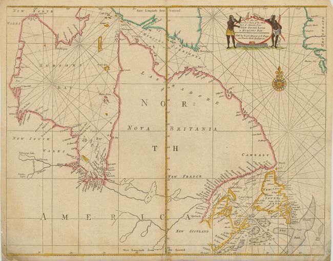
Subject: Eastern Canada

Period: 1753 (circa)

Publication: The English Pilot, The Fourth Book

Color: Hand Color

Size:
21.8 x 17 inches
55.4 x 43.2 cm
Download High Resolution Image
(or just click on image to launch the Zoom viewer)

Fifth state of this important sea chart focusing on the coastal features of Hudson Bay and Labrador from the plate by John Thornton. Hudson and James bays are well-depicted for the period. Labrador, Quebec and the Ungava Peninsula are shown as being separated from the rest of Canada by the Frenchman River, shown reaching all the way from James Bay to Atlantic. Soundings are noted in the fishing banks. The title cartouche is flanked with figures and animals, and rhumb lines along with a fine compass rose complement the map.

References: Verner and Stuart-Stubbs #31; Kershaw #223.

Condition: B

Dark impression. The sheet has a split in the bottom centerfold about 1.5" into map. Bottom corners with some repairs and soil. One small wormhole in the lower, blank portion of map.

Estimate: $500 - $600

Sold for: $300

Closed on 7/18/2007

Archived