Catalog Archive
Auction 119, Lot 780

"A Generall Mapp of the Kingdome of Tartaria Designed by Monsieur Sanson…", Blome, Richard

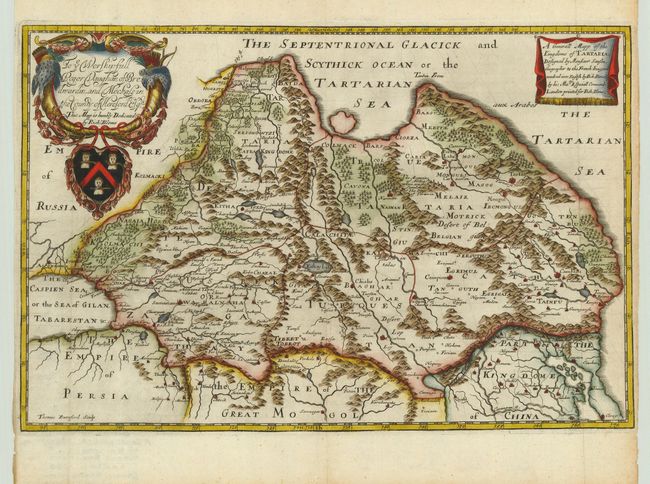
Subject: Asia - Northern

Period: 1680 (circa)

Publication: Geographical Description of the Four Parts Of The World

Color: Hand Color

Size:
15.3 x 10.2 inches
38.9 x 25.9 cm
Download High Resolution Image
(or just click on image to launch the Zoom viewer)

This elaborately engraved map covers northern and central Asia, at the time, the Kingdom of Tartary. To the south are the empires of Persia, The Great Mogol, and China. The map is embellished with a large, heraldic cartouche including a dedication to Roger Vaughan. This map is based on the cartography of Nicolas Sanson and was engraved by Thomas Burnford. Richard Blome was one of the most interesting, and most active, publishers of illustrated books in post-Restoration London. There is an excellent biography on href="http://www.mapforum.com/09/9blome.htm">MapForum.com.

References:

Condition: A

Minor toning in blank margins with close (1/8") side margins, as issued.

Estimate: $450 - $500

Unsold

Closed on 5/9/2007

Archived