Catalog Archive
Auction 119, Lot 400

"Dominia Anglorum in Praecipuis Insulis Americae…", Homann Heirs

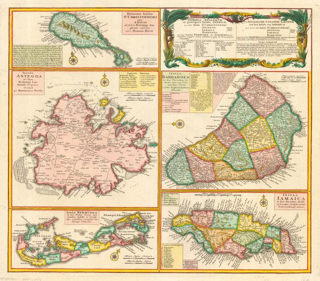
Subject: Caribbean and Bermuda

Period: 1740 (circa)

Publication:

Color: Hand Color

Size:
22 x 19.3 inches
55.9 x 49 cm
Download High Resolution Image
(or just click on image to launch the Zoom viewer)

A large and striking sheet with five maps describing the islands of St. Kitts, Antigua, Bermuda, Barbados and Jamaica. All of these maps were copied from separate maps made by Herman Moll in 1729. Each map is meticulously detailed with its own compass rose, soundings, roads, topography and political divisions as well as descriptive text and keys. The map has a second title in Dutch: Die Englische Colonie-Laender auf den Insuln von America.`

References: Sellers & Van Ee #1723.

Condition: A

A couple of short, marginal tears in the lower blank margin that have been repaired with archival tape, else fine.

Estimate: $700 - $950

Sold for: $600

Closed on 5/9/2007

Archived