Catalog Archive
Auction 119, Lot 39

"Map of the World From the Best Authorities", Brightly & Kinnersly
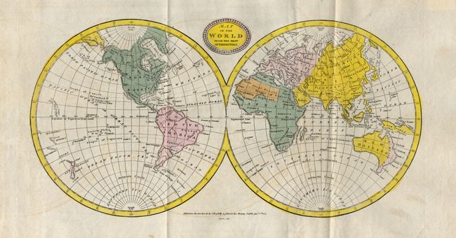
Subject: World

Period: 1818 (published)

Publication:

Color: Hand Color

Size:
13.8 x 7 inches
35.1 x 17.8 cm
Download High Resolution Image
(or just click on image to launch the Zoom viewer)

This double hemispheric world map incorporates the discoveries of Capt. Cook. Of interest is the depiction of a huge New South Wales that stretches across the entire east coast of New Holland from Van Diemans Land (still attached) to the Cape York Peninsula. New Guinea's southern coastline is indistinctly drawn. Published by the seldom seen house of Brightly and Kinnersly in Suffolk. Dated 1807 but the fine machine-made paper bears two large "1818" watermarks.

References:

Condition: B

Near fine example less some light offsetting. Upper edge of paper with some browning, far from map image. Some genealogical information on verso in ink, with no show-through to map.

Estimate: $100 - $120

Sold for: $75

Closed on 5/9/2007

Archived