Catalog Archive
Auction 119, Lot 327

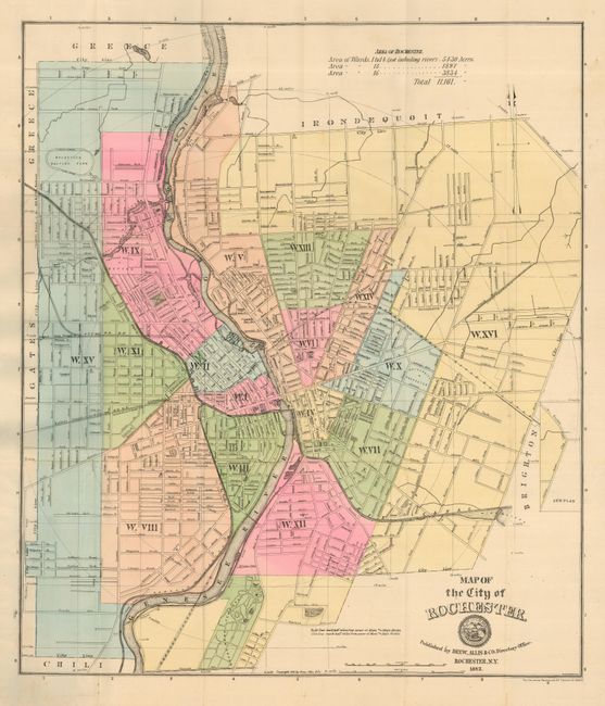
"Map of the City of Rochester",

Subject: New York, Rochester

Period: 1882 (dated)

Publication:

Color: Hand Color

Size:
23 x 20 inches
58.4 x 50.8 cm
Download High Resolution Image
(or just click on image to launch the Zoom viewer)

A quaint example of a late 19th century city plan that includes an Index to Streets, Fire Alarm Boxes, Blocks, Buildings, Halls, etc.. A scale at the top of the map gives the total acreage of the 16 wards of the city. Numerous points of interest are located here including reservoirs, cemeteries, the University of Rochester and the Rochester Driving Park, a 1 mile oval racetrack. Map folds into the original hardboard, green cloth covers with gilt title on front cover.

References:

Condition: B

Several fold separations and light soiling. Edges just a bit ragged. Evidence of water exposure to the covers, still a nice copy with a sharp impression.

Estimate: $120 - $220

Sold for: $60

Closed on 5/9/2007

Archived