Catalog Archive
Auction 119, Lot 294
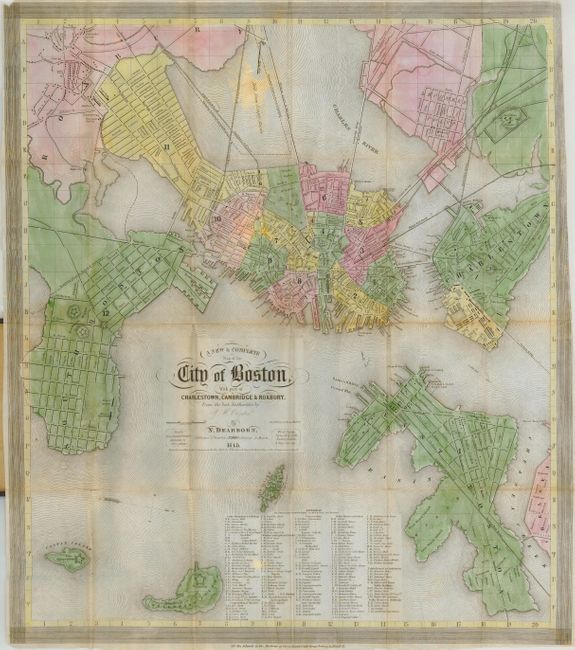
"A New & Complete Map of the City of Boston with Part of Charlestown, Cambridge & Roxbury from the Best Authorities", Boynton, George W.
1 of 2
Subject: Massachusetts, Boston
Period: 1845 (dated)
Publication:
Color: Hand Color
Size:
15.5 x 18 inches
39.4 x 45.7 cm
Download High Resolution Image
(or just click on image to launch the Zoom viewer)
(or just click on image to launch the Zoom viewer)