Catalog Archive
Auction 119, Lot 219

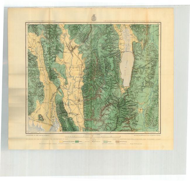
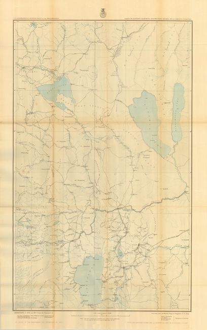
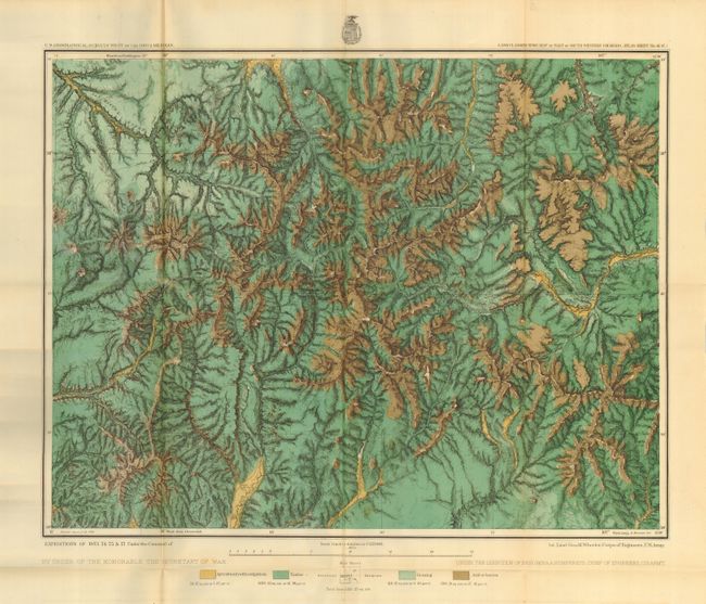
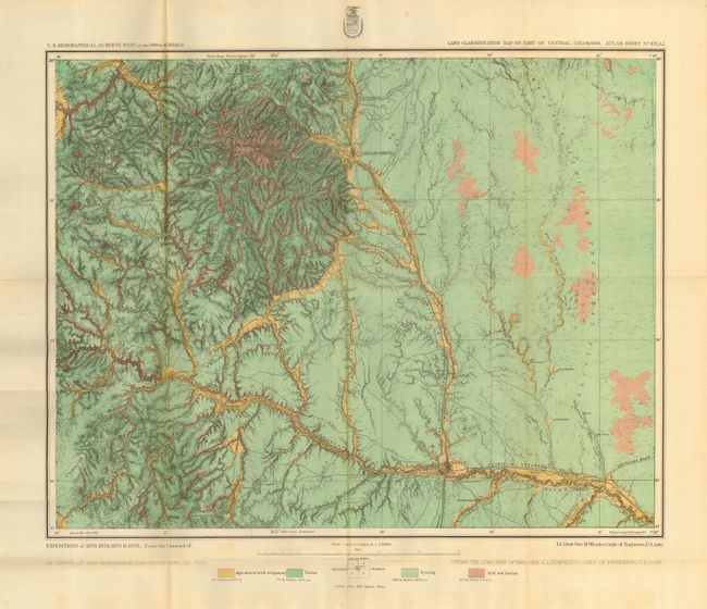
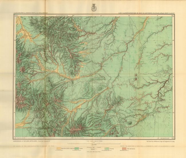
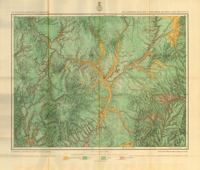
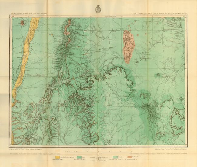
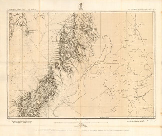
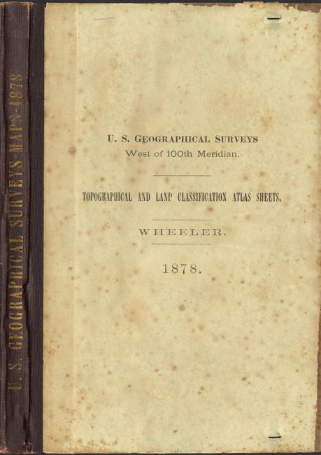
"[Lot of 8] U.S. Geographical Surveys West of the One Hundredth Meridian. Topographical and Land Classification Atlas Sheets", Wheeler, George (Lt)

Subject: Western United States

Period: 1878 (dated)

Publication:

Color: Printed Color

Size:
20 x 15 inches
50.8 x 38.1 cm
Download High Resolution Image
(or just click on image to launch the Zoom viewer)

This lot is a booklet comprised of eight maps issued at the end of fiscal year 1878 (June 30th). The maps are folding and contained in the original hardbound cover. Together, the maps cover parts of California, Nevada, Utah, Idaho, Colorado and New Mexico. Each map is numbered on verso to match the printed list pasted to inside cover, as issued. This original paper label lists the maps, with the fourth map lined out in contemporary ink, suggesting the map was not issued with this set.

1) Land Classification Map of North-Eastern Utah and South-Eastern Idaho, Atlas Sheet No. 41 (B). Includes Bear Lake and a portion of Bear River drainage, and lying mostly in the Great Salt Lake Basin. Locates Logan, Malad (here Malade), Hyrum and more.
2) Parts of Eastern California and Western Nevada, Atlas Sheets 47 (B) & 47 (D). Two sections on one large sheet. Includes portions of the American Fork and Yuba Rivers, Carson and Truckee Rivers, Tahoe, Pyramid and Honey Lakes, and a portion of the Sierras, through which the Central Pacific Railroad passes. Locates Reno. (Double sheet, 18.8 x 30.5")
3) Land Classification map of Part of South Western Colorado, Atlas Sheet No. 61 (C). This brightly colored map includes the basins of a number of tributaries of the Gunnison River from the south, and the headwaters of the Rio Grande and of a number of streams flowing into the San Juan. The Continental Divide traverses the southeastern and eastern parts of the sheet in horseshoe form. The greater portion of the San Juan Mining District is also detailed.
4) Land Classification Map of Part of Central Colorado, Atlas Sheet No. 62 (A). Locates Pueblo and Colorado Springs. Details portions of the Arkansas Valley from the vicinity of Pueblo to the westward, and bordering on the Plains. Pike's Peak appears near the northern limit of the sheet, and the "Fontaine qui bouille," rising near, joins the Arkansas, in its course, at Pueblo.
5) Land Classification Map of Part of Southern Colorado, Atlas Sheet No. 62 (C). This map details the drainage of a number of creeks reaching the Arkansas from the south, the Sangre de Christo Mountains and other ridges dividing the Arkansas from the San Luis Valley. Locates Veta Peak.
6) Land Classification Map of Part of Central New Mexico, Atlas Sheet No. 69 (D), Colorful map that locates Taos and Santa Fe. Details a portion of the Rio Grande Valley.
7) Land Classification Map of Part of Central New Mexico, Atlas Sheet No. 77 (D). With part of New Mexico, including a portion of the Rio Grande Valley, and mountain ridges to the eastward south of Albuquerque.
8) Part of Southern New Mexico, Atlas Sheet No. 84 (B). The map includes a part of the drainage basin of the Pecos in the eastern and of the Rio Grande in the northwestern portion; also the northern extension of the Jornada barren plain, a peculiarly marked lava flow west of the San Andreas Mountains, several minor mountain ranges and Fort Stanton. (In skeleton, showing hachuring in part only.)

Most of the maps are attractively colored in green and ochre. Sizes vary slightly, but generally as given except the double sheet map as noted above. Hard covers in paper with leather spine with gilt stamped title. A scarce collection showing Wheeler's survey efforts from his expedition of 1876 & 1877. The Phillips reference is a full accounting of Wheeler's maps, 179 in all, made over the years 1869 - 1882.

References: Phillips (A) #1281

Condition: A

Most maps are very good or fine. Occasional toning on a fold visible on verso, but not on map side. Cover has foxing on paper section.

Estimate: $900 - $1,100

Unsold

Closed on 5/9/2007

Archived