Catalog Archive
Auction 118, Lot 943

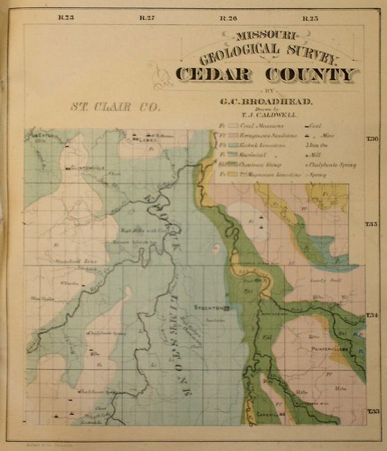
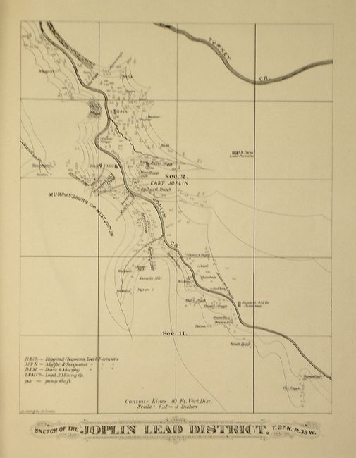
"Atlas Accompanying Reports of Missouri Geological Survey", U.S. State Surveys

Subject: Atlases

Period: 1874 (dated)

Publication:

Color: Hand Color

Size:
13 x 15 inches
33 x 38.1 cm
Download High Resolution Image
(or just click on image to launch the Zoom viewer)

An excellent example of a very early and scarce geologic atlas. Several of the maps are hand colored, and drawn by T.J. Caldwell. The 15 maps and sketches, lithographed by A. Gast & Co., St. Louis, show the geologic deposits and some of the topography of various counties and regions in Missouri. The maps are of:
Cedar County,
Barton County,
Vernon County,
Bates County,
Howard County,
Part of Northern Missouri,
Madison County,
Geological Map of Jasper County with Lead region of Jasper and Newton Counties,
Sketch of the Joplin Lead District,
Map of the Lead Region of Central Missouri,
Map of the Granby Mines,
Grouped Sections in Northeast Missouri,
Sections in Barton County,
Sections in Bates and Vernon Counties,
andGrouped Sections in Howard Co. By C.J. Norwood. Softbound, published without a title page, folio.

References:

Condition: B

Fragile with edges frayed, covers with some soiling and shelf wear, corners bumped and spine with some separation. Maps with some fading and toning. Both fold out maps have minor fold separations.

Estimate: $400 - $600

Sold for: $250

Closed on 3/6/2007

Archived