Catalog Archive
Auction 118, Lot 899

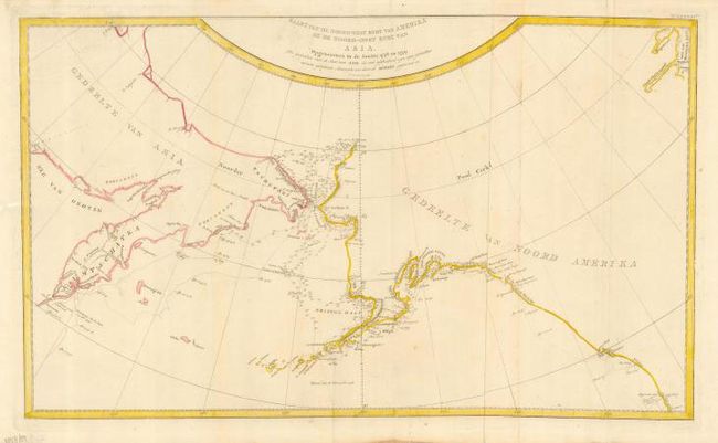
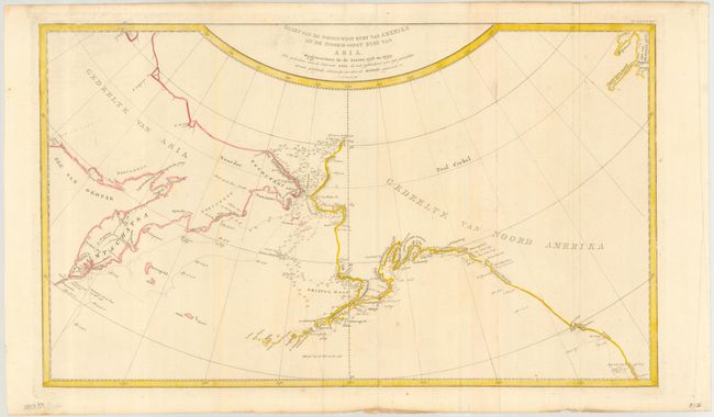
"Kaart van de Noord-West Kust van Amerika en de Noord-Oost Kust van Asia. Opgenoomen in de Jaaren 1778 en 1779…", Cook, James (Capt.)

Subject: North Pacific, Alaska

Period: 1795 (circa)

Publication:

Color: Hand Color

Size:
25.3 x 15 inches
64.3 x 38.1 cm
Download High Resolution Image
(or just click on image to launch the Zoom viewer)

This large map is centered on the Bering Strait with soundings and dates, charting Cook's third voyage up the northern reach of the Pacific in his search for a Northwest Passage. Cook probed up along the Oregon coast in bad weather to Nootka Sound, where he rested and refitted his ships. They sailed forth to the Alaskan and Chukotskiy peninsulas and from there into the Bering Strait. Cook got as far north as 70° 41’ N before being forced back by the pack ice off Icy Cape. The expedition came south down the Russian coast and then east to Norton Sound. Cook's expedition then sailed south to Hawaii, where Cook was killed in a dispute with the natives. His second-in-command Clerke took over the expedition and they explored further in Hawaii before returning north to continue the exploration for the Northwest Passage.

References:

Condition: B

Printed to two joined sheets and issued folding, now pressed. Some light soil in map and rough paper edges, well away from map.

Estimate: $350 - $400

Unsold

Closed on 3/6/2007

Archived