Catalog Archive
Auction 118, Lot 827

"Plan de la Ville de Meaco", Charlevoix, P. F. Xavier de

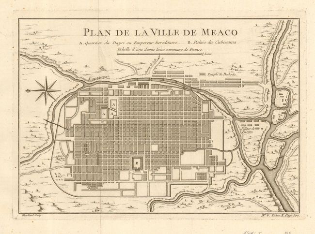
Subject: Japan, Kyoto

Period: 1736 (published)

Publication: Histoire et Description Generale du Japon

Color: Black & White

Size:
10.8 x 7.5 inches
27.4 x 19.1 cm
Download High Resolution Image
(or just click on image to launch the Zoom viewer)

Early plan of the Imperial city of Kyoto with the surrounding countryside. Modeled on the Kaempfer-Scheuchzer map of 1727, it shows the layout of the city with the principal places of the Emperor and Shogun and the Temple de Daibods. A compass rose orients the map with north to the left. Engraved by Guillaume Dheulland from a map drawn by J. N. Bellin, who prepared some of the maps for Charlevoix's work.

References: Campbell, [MCC-36] #56.

Condition: A+

Very crisp impression. With folds, as issued.

Estimate: $150 - $200

Sold for: $110

Closed on 3/6/2007

Archived