Catalog Archive
Auction 118, Lot 789

"[Lot of 3 - Holy Land]", Various

Subject: Holy Land

Period: 1614-1750 (circa)

Publication:

Color: Hand Color

Size:
See Description
Download High Resolution Image
(or just click on image to launch the Zoom viewer)
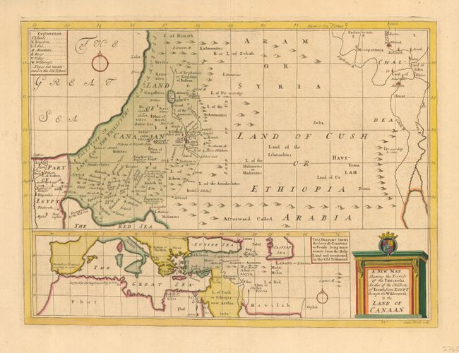
1) A New Map Shewing the Travels of the Patriarchs, As also the Children of Israel, from Egypt through the Wilderness, to the Land of Canaan by Edward Wells from "A New Sett of Maps both Antient and Present Geography," c. 1700 (19.5 x 14.2"). Nicely engraved map of the Land of Canaan or present Israel, and stretching through the Land of Cush or Ethiopia Arabia over to include Babylon and the Land of Eden. At the bottom is another map of the Mediterranean and central Asia with the notation "This Draught shews the several Countries or People lying most remote from the Holy Land and mentioned in the Old Testament." Engraved by Sutton Nicholls. Fine impression printed on sturdy paper with attractive old color.

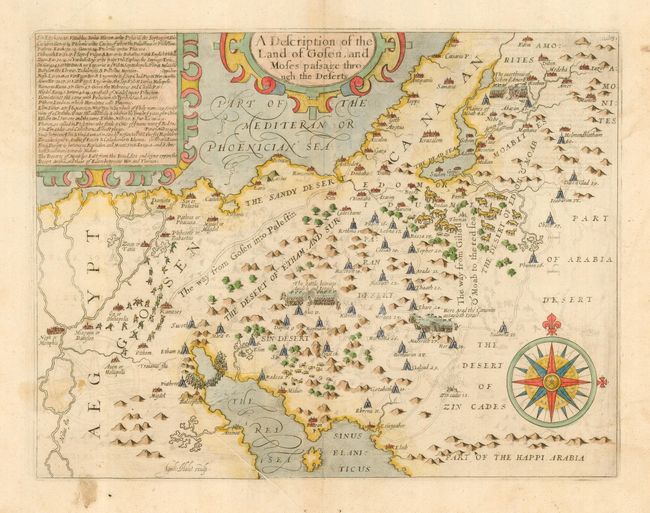
2) A Description of the Land of Gosen, and Moses passage through the Deserts by William Hole, c. 1614, (14.4 x 11") Attractive and uncommon map showing the Exodus and decorated with two large strapwork cartouches and a fine compass rose. Light offsetting and a couple of minor spots, minor printer's crease.

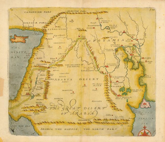
3) An untitled map engraved by Emanual Bowen, c. 1750 (13.6 x 11.6") The map covers the whole of the Middle East from Cyprus to Babylon and from the Red Sea to the Persian Gulf. The focus of the map is the Passage of Abraham from Charran to Sichem, which is graphically shown. F: 37 is engraved in upper right corner. The lower left corner shows evidence of plate damage, where Bowen's imprint was in early editions. Some stains, tape and a tear in blank margins, not affecting map.

References:

Condition: B

See descriptions.

Estimate: $550 - $800

Sold for: $400

Closed on 3/6/2007

Archived