Catalog Archive
Auction 118, Lot 763

"Asiae Nova Descriptio", Hondius, Jodocus
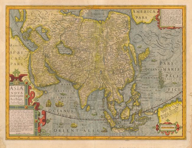
Subject: Asia

Period: 1628 (published)

Publication:

Color: Hand Color

Size:
20 x 14.8 inches
50.8 x 37.6 cm
Download High Resolution Image
(or just click on image to launch the Zoom viewer)

This excellent map of Asia was Hondius’ update of Mercator’s map of 1595. Though it corrected many of Mercator’s errors, the map still has many interesting early depictions. Korea is shown as a very long island. Japan is depicted on the Ortelius/Teixeria model with three principal islands. In India, the Gulf of Cambay is very exaggerated but the shape of Ceylon has been improved. The mythical Chami Lacus appears to the northeast of India. The Philippines are marked as the Philippina Insulae, as well as Archipelagus S. Lasari, Magellan’s original name for the group. The southern coastline of Java is left blank. The northern coastline of New Guinea includes many place names from Spanish expeditions, and there is a note that it is unknown if New Guinea is a part of Terra Australis. Across the Anian Fretum lies part of North America, labeled Americae Pars, with a cartouche notation concerning the searches for a Northwest Passage. The map is richly decorated with strapwork cartouches, ships, numerous sea monsters. This example is from a French edition of 1628.

References: Yeo #20; Walter #24.

Condition: B

Generally attractive map with some old paper repairs and archival tape repairs on the verso at the margins, extending and reinforcing some fraying there. Later color with a some bleed-through through on verso. Tiny bit of worming near lower centerfold in blank area of sea.

Estimate: $950 - $1,200

Sold for: $800

Closed on 3/6/2007

Archived