Catalog Archive
Auction 118, Lot 705
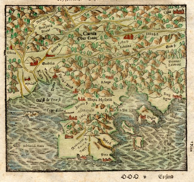
"[Istria]", Munster, Sebastian
1 of 2
Subject: Croatia
Period: 1598 (published)
Publication: Cosmographia
Color: Hand Color
Size:
6.3 x 5.2 inches
16 x 13.2 cm
Download High Resolution Image
(or just click on image to launch the Zoom viewer)
(or just click on image to launch the Zoom viewer)