Catalog Archive
Auction 118, Lot 62

"Nova et Accurata Poli Arctici et Terrarum Circum Iacentium Descriptio", Waesberger, Johann
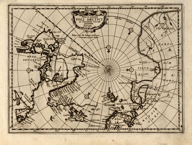
Subject: North Pole

Period: 1676 (published)

Publication: Nieuwe en beknopte Uytbeeldinghe…

Color: Black & White

Size:
9.6 x 7.3 inches
24.4 x 18.5 cm
Download High Resolution Image
(or just click on image to launch the Zoom viewer)

This scarce map is a reduced version of Jansson's important map of the Arctic that became the prototype for north polar projections for many later maps. The land bridge between the northern end of Nova Zembla and the mainland is considerably exaggerated. Johann Waesberger, also known as Jansson van Waesberge, was Jan Jansson's son-in-law and acquired many of Jansson's plates by inheritance including those of the Atlas Minor. This engraving is decorated with a charming strapwork cartouche and many compass roses.

References: Kershaw #117.

Condition: A

Handsome, sharp impression. The map has a small worm hole just inside the neatline in the lower left corner, otherwise it is fine.

Estimate: $450 - $600

Sold for: $325

Closed on 3/6/2007

Archived