Catalog Archive
Auction 118, Lot 592
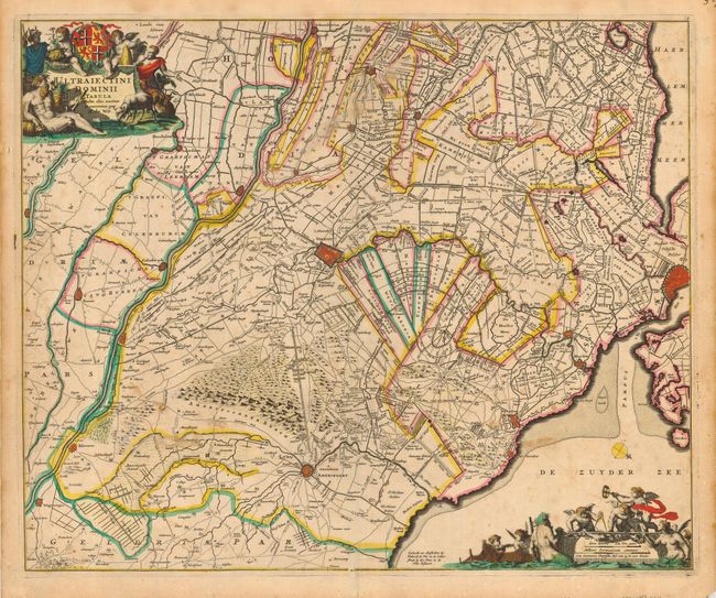
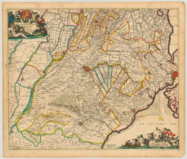
"Ultraiectini Dominii Tabula…", Wit, Frederick de
1 of 2
Subject: Netherlands
Period: 1690 (circa)
Publication:
Color: Hand Color
Size:
22 x 18 inches
55.9 x 45.7 cm
Download High Resolution Image
(or just click on image to launch the Zoom viewer)
(or just click on image to launch the Zoom viewer)