Catalog Archive
Auction 118, Lot 512

"A Chart of the Atlantic or Western Ocean … Wherein is delineated the Track of his Majesty's Fleet, Commanded by the late Viscount Nelson…", Faden, William

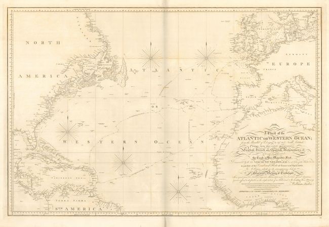
Subject: Atlantic Ocean

Period: 1807 (dated)

Publication: Admiralty

Color: Black & White

Size:
35.8 x 23.8 inches
90.9 x 60.5 cm
Download High Resolution Image
(or just click on image to launch the Zoom viewer)

This very scarce chart of the Atlantic Ocean includes the eastern coast of North America, the West Indies and the northern part of South America, and the coasts of western Europe and northwest Africa. The tracks of Nelson's flagship H.M.S. Victory is delineated across the Atlantic in pursuit of the "Combined Fleets of France and Spain in 1805. A Course which in its consequences led to the Glorious Victory of Trafalgar." Faden copied this chart from Nelson's original manuscript and notes that it is "offered to the public as the slight tribute of an Individual to His Lordship's Fame & Memory."

References:

Condition: B

Some faint foxing and a manuscript notation (Light R.) in red ink near C. St. Vincent, Portugal. Old repairs on short fold separations, else very good for such a large chart.

Estimate: $500 - $700

Sold for: $375

Closed on 3/6/2007

Archived