Catalog Archive
Auction 118, Lot 50

"Map of the World on a Globular Projection…", Sherman & Smith
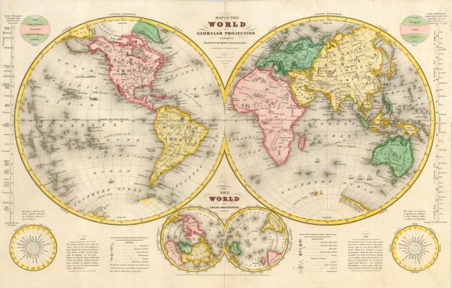
Subject: World

Period: 1844 (dated)

Publication: Olney's School Geography

Color: Hand Color

Size:
18 x 10.6 inches
45.7 x 26.9 cm
Download High Resolution Image
(or just click on image to launch the Zoom viewer)

This double hemisphere map of the world features the Independent Republic of Texas. The attractive sheet includes six additional hemispheres, including a double polar projection below the map. Filled with a remarkable amount of information for a school map; it includes icons indicating the predominate religion, notes on time, and the route of the U.S. Exploring Expedition in 1842. Another set of icons indicate the State of Society as Savage, Half Civilized, Civilized, and Enlightened. Thematic scales at sides give the longest day at different latitudes, and the other shows the highest mountains, also by latitude.

References:

Condition: A

Bright color and impression with full, original margins. Two short splits along centerfold at top and bottom, not entering map and professionally closed on verso.

Estimate: $90 - $120

Sold for: $110

Closed on 3/6/2007

Archived