Catalog Archive
Auction 118, Lot 464

"Het Eyland Antigua Antego of Santa Maria el Antigua…", Keulen, Johannes van
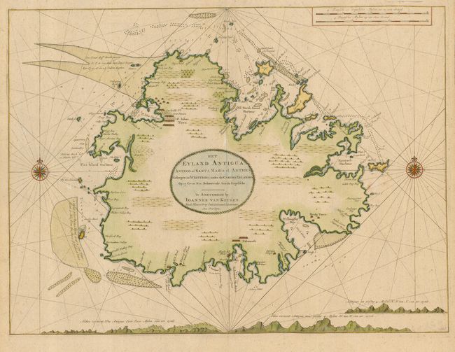
Subject: Antigua

Period: 1720 (circa)

Publication:

Color: Hand Color

Size:
22.8 x 17 inches
57.9 x 43.2 cm
Download High Resolution Image
(or just click on image to launch the Zoom viewer)

This is a very fine chart of the island of Antigua focusing on the seacoast with soundings, shoals and navigational hazards well delineated. The coastline is noted with place names and the locations of towns, ports, forts and sugar works. The interior is left largely blank and adorned with the large title cartouche. Johannes Van Keulen was the patriarch of perhaps the most prolific of all Dutch map making families. The family firm commenced in 1680 and dominated Dutch sea chart publishing throughout the 18th century until the opening of the Dutch Hydrographic Office in the 19th century.

References: Tooley (MCC-55) #9.

Condition: A

Printed on heavy paper with a fine impression and nice color. Couple of fine minute spots of foxing, still nearly fine.

Estimate: $1,900 - $2,300

Sold for: $950

Closed on 3/6/2007

Archived