Catalog Archive
Auction 118, Lot 461

"Bowles's New One-Sheet Map of the West Indies, Laid Down from the Observations of the Most Celebrated Geographers", Bowles & Carver
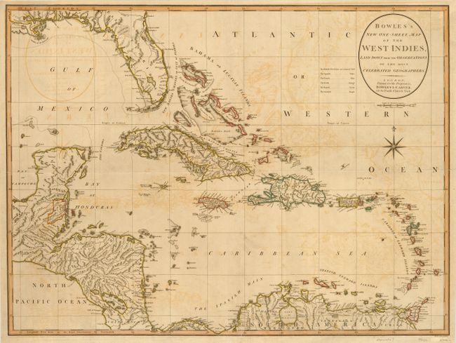
Subject: Caribbean

Period: 1798 (circa)

Publication:

Color: Hand Color

Size:
27 x 20.1 inches
68.6 x 51.1 cm
Download High Resolution Image
(or just click on image to launch the Zoom viewer)

Extremely uncommon, perhaps separately issued map of the West Indies. The map is filled with interesting detail of the tip of Florida, the Bahamas, Cuba, Hispaniola, Jamaica, Porto Rico, the Leeward Islands, the northern tip of South America and a portion of Central America, including Panama, Costa Rica and the Yucatan. The present-day country of Belize is noted as a British settlement on the map. Spain continually attempted to expel British buccaneers from the Spanish territory, but finally signed treaties in 1786 allowing the British to continue to harvest timber and settle in that area in exchange for protection against pirates. The map has a colored key to the various colonial possessions of countries to the left of the title cartouche.

References:

Condition: B

Original outline color with some offsetting. Folded vertically and horizontally with short fold separations just entering map.

Estimate: $500 - $600

Sold for: $375

Closed on 3/6/2007

Archived