Catalog Archive
Auction 118, Lot 455

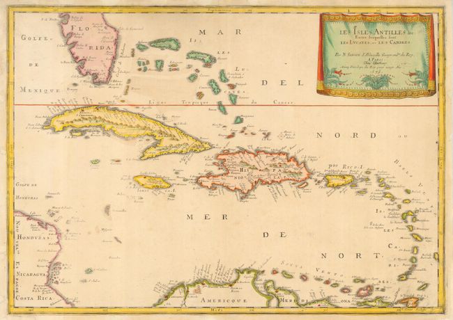
"Les Isles Antilles &c. entre lesquelles sont les Lucayes, et les Caribes", Sanson, Nicolas

Subject: Caribbean

Period: 1679 (dated)

Publication:

Color: Hand Color

Size:
21.5 x 15.3 inches
54.6 x 38.9 cm
Download High Resolution Image
(or just click on image to launch the Zoom viewer)

Beautiful map of the Caribbean from the tip of Florida to the western coast of Central America and the northern coast of South America. The map shows excellent detail of the Bahamas, Cuba, Jamaica, Hispaniola, Puerto Rico and the Windward Islands. This is the 1679 issue of the 1656 publication by Mariette, with the date changed in the cartouche. The map is decorated with a delicately engraved, drape-style cartouche.

References:

Condition: B

Margins trimmed, but still adequate for framing. Professional conservation of damaged margins.

Estimate: $750 - $1,000

Sold for: $550

Closed on 3/6/2007

Archived