Catalog Archive
Auction 118, Lot 447

"Mappa Geographica, complectens I. Indiae Occidentalis Partem Mediam Circum Isthmum Panamensem…", Homann Heirs

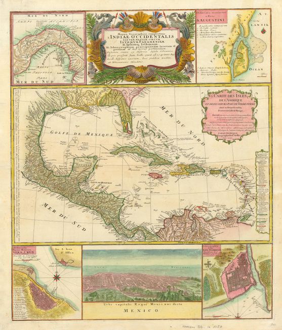
Subject: Gulf of Mexico and Caribbean

Period: 1740 (circa)

Publication:

Color: Hand Color

Size:
19.2 x 23 inches
48.8 x 58.4 cm
Download High Resolution Image
(or just click on image to launch the Zoom viewer)

Informative and very graphic folio sheet with a large map of the region, titled Carte des Isles de l'Amerique et Deplusieurs Pays de Terre Ferme, attributed to D'Anville (1731). It covers the Gulf of Mexico, Central America and all of the Caribbean islands. It is nicely detailed with a color key to show European possessions and a beautifully engraved title cartouche. Above the main map is the large and decorative title cartouche, flanked by insets of the isthmus of Panama and a plan of St. Augustine in Florida. Below the map is a large view of Mexico City, flanked by plans of Vera Cruz and San Domingo. A very handsome sheet, absolutely filled with information on the West Indies.

References:

Condition: A

Light uneven toning in the map. One printer's crease in the lower right corner, still very good.

Estimate: $800 - $1,000

Sold for: $1,300

Closed on 3/6/2007

Archived