Catalog Archive
Auction 118, Lot 42

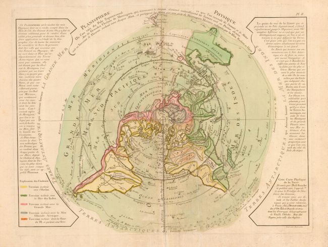
"Planisphere Physique Ou l'on voit du Pole Septentrional ce que l'on connoit de Terres et de Mers…", Buache/Dezauche

Subject: World

Period: 1753 (circa)

Publication:

Color: Hand Color

Size:
17.3 x 13.5 inches
43.9 x 34.3 cm
Download High Resolution Image
(or just click on image to launch the Zoom viewer)

This is a scarce and very unusual thematic map designed to illustrate the watersheds of the world. The map is presented on a North Polar projection. Strong hachures show the major mountain ranges and color is used to depict the watershed for each of the oceans. In North America there is a large Sea of the West and a nearly complete Northwest Passage. Australia is still shown with a conjectural coastline, making it considerably too wide. The continent connects to both New Guinea and Terre du St. Esprit (the Land of the Holy Ghost), discovered by Queiroz.

References: Potter pp.178-9 (illus).

Condition: B

Original color. Bit of minor foxing and some extraneous creasing at center.

Estimate: $550 - $650

Sold for: $400

Closed on 3/6/2007

Archived