Catalog Archive
Auction 118, Lot 421

"Mexico and Guatimala", Hall, Sidney
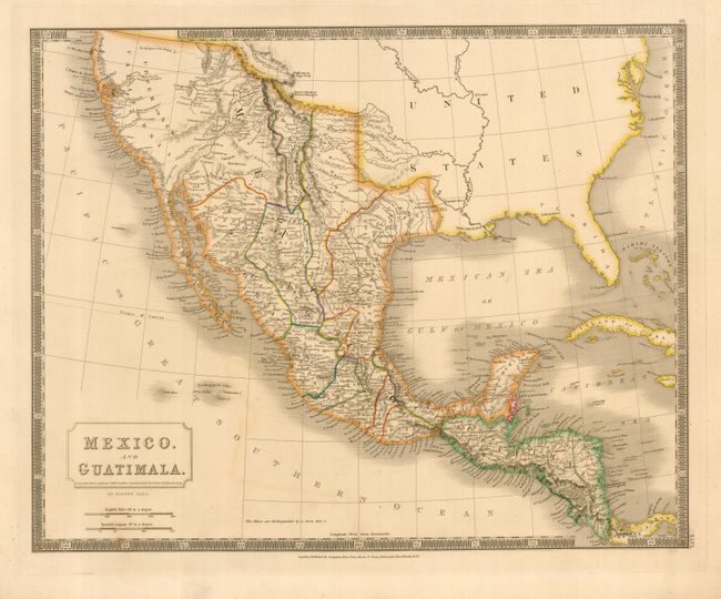
Subject: Southwestern United States, Mexico, Central America

Period: 1828 (dated)

Publication: A New General Atlas

Color: Hand Color

Size:
20 x 16 inches
50.8 x 40.6 cm
Download High Resolution Image
(or just click on image to launch the Zoom viewer)

This is a large, detailed map of the region stretching from California to Panama. A notation below the title says the map was corrected with information supplied by Simon A. G. Bourne, Esq. It shows the political divisions of Mexico, which include Texas, New Mexico and Upper California. There is fine detail of the topography, cities, towns, mines and roads, including the Great Spanish Road that links Santa Fe with the Red River. Several rivers in California are shown by dotted lines to connect the large interior lakes of Timpanogoes and Teguayo with the Pacific.

This map is largely unknown as a significant map in the history of Texas, as it is the first published map to incorporate Stephen Austin’s first-hand knowledge of the region. Simon Bourne, a British friend of Austin, made a copy of Austin's manuscript map of Texas. Upon returning to England he shared the information with Sidney Hall, who produced this map. It shows a number of settlements and roads in Texas.

References: Wheat [TMW] #381.

Condition: A

Lovely original color with a slight bit of offsetting, else near fine.

Estimate: $400 - $450

Sold for: $375

Closed on 3/6/2007

Archived