Catalog Archive
Auction 118, Lot 413

"Le Vieux Mexique ou Nouvelle Espagne avec les costes de la Floride", Fer, Nicolas de

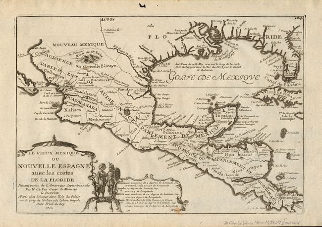
Subject: Southern United States & Mexico

Period: 1705 (dated)

Publication: L'Atlas Curieux

Color: Black & White

Size:
13 x 9 inches
33 x 22.9 cm
Download High Resolution Image
(or just click on image to launch the Zoom viewer)

This attractive small map covers the Gulf of Mexico through Central America and includes parts of Cuba and Jamaica. It extends through Mexico to show the southern tip of Baja California. This is an early map to show the correct location of the Mississippi River delta gleaned from the expeditions of La Salle and Iberville. Almost all prior maps had the mouth further west into present-day Texas. The Rio Grande (Rio Bravo ou del Nord) is also shown flowing correctly into the Gulf of Mexico rather than into the Gulf of California. Two French forts are located: LaSalle's Fort St. Louis in Texas (Fortbati en 1685) and another near present-day New Orleans. One of the prominent features in northern Mexico is Les Fameuses Mines de Ste. Barbe, the legendary Santa Barbara mines of the Chihuahua-Durango region. The cartouche features two native figures.

References:

Condition: B

Lovely impression. One small stain just into lower neatline. Some worming in upper, blank margin, well away from the map.

Estimate: $550 - $700

Sold for: $400

Closed on 3/6/2007

Archived