Catalog Archive
Auction 118, Lot 40

"Essay d'une Carte Reduite, Contenant les Parties Connuees du Globe Terrestre", Bellin, Jacques Nicolas
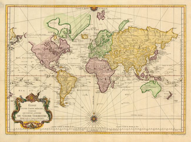
Subject: World

Period: 1748 (dated)

Publication: La Harpe's Abrege de l'Histoire Generale des Voyages

Color: Hand Color

Size:
27.3 x 19.7 inches
69.3 x 50 cm
Download High Resolution Image
(or just click on image to launch the Zoom viewer)

This is a very large world chart presented on Mercator's projection, that originated in 1748 and went through several revisions until the turn of the century. North America is shown with a Fl. de l' Ouest connecting through a series of rivers and lakes from Lake Superior to the Pacific - representing the elusive Northwest Passage. The Russian discoveries in the North Pacific show Alaska as an island named I. Unamak. Australia is labeled Nouvelle Hollande with Terre de Diemen linked to the mainland. New Zealand is fully formed and there are numerous islands in the Pacific. Large, decorative title cartouche and two fine compass roses with rhumb lines make this a very attractive chart. There is a note on the map dated 1760, and the geography shows the discoveries from Cook's first voyage to Tahiti, New Zealand and Australia from 1769-71. The map was published circa 1780.

References:

Condition: A

With folds as issued, and a couple of short, marginal fold splits.

Estimate: $800 - $1,000

Sold for: $600

Closed on 3/6/2007

Archived