Catalog Archive
Auction 118, Lot 406

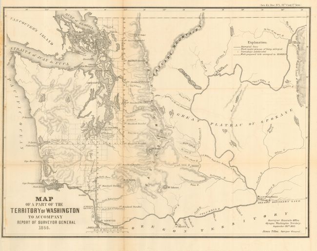
"Map of a Part of the Territory of Washington to Accompany Report of Surveyor General", General Land Office

Subject: Washington

Period: 1855 (dated)

Publication: Sen. Ex. Doc. No. 1 34th Cong. 1st Sess.

Color: Black & White

Size:
19.3 x 14.3 inches
49 x 36.3 cm
Download High Resolution Image
(or just click on image to launch the Zoom viewer)

This uncommon map was executed by James Tilton, Surveyor General, from the Olympia office. This is the first GLO map of Washington Territory, issued just 28 months after its creation. The map shows limited survey progress with modest detail west of the Cascades. In the east, only major rivers are shown. Several forts (Steilacom, Nisqually, Walla Walla, & Townsend) are located and Seattle is labeled Statle. Legend at upper right identifies surveyed lines, surveys under progress, townships subdivided, and proposed surveying for the 1856 & 57 season. This historical and infrequently offered map is well-drawn on a scale of 1"=18 miles.

References:

Condition: B

Folding, as issued. Full, original margins and good impression. Lightly toned along fold, else near fine.

Estimate: $250 - $350

Sold for: $130

Closed on 3/6/2007

Archived