Catalog Archive
Auction 118, Lot 367

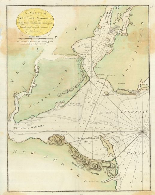
"A Chart of New York Harbour with the Banks Soundings and Sailing marks from the most accurate Surveys & Observations", Mount & Page

Subject: New York

Period: 1789 (published)

Publication: The English Pilot, fourth book

Color: Hand Color

Size:
18.2 x 23.5 inches
46.2 x 59.7 cm
Download High Resolution Image
(or just click on image to launch the Zoom viewer)

Uncommon and important chart of New York Harbor updated to show many new shoals, channels, soundings, navigational sightings, and landmarks. Detail is confined to the waterways. The footprint of New York City is enlarged from their earlier chart. This map only appeared in the late edition of the English Pilot.

References: Sellers & Van Ee #1236.

Condition: C

Two mirror image stains in upper part with damage in margins in the same area. Map has been backed with Japanese tissue to strengthen paper, with some loss of left margin.

Estimate: $1,200 - $1,500

Sold for: $500

Closed on 3/6/2007

Archived