Catalog Archive
Auction 118, Lot 354

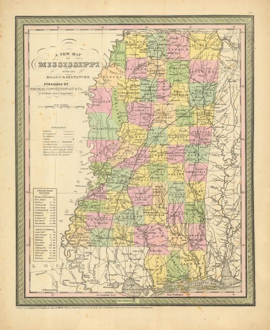
"A New Map of the State of Mississippi with its Roads and Distances", Thomas, Cowperthwait & Co.
Subject: Mississippi

Period: 1850 (dated)

Publication: Mitchell's New Universal Atlas

Color: Hand Color

Size:
11.6 x 14 inches
29.5 x 35.6 cm
Download High Resolution Image
(or just click on image to launch the Zoom viewer)

Very handsome, pre-Civil War map of Mississippi. The map is nicely colored in pastels by county with a decorative engraved border and title. Copyright dated in 1850, the map shows Calhoun County, which was created from Chickasaw County in 1852. Small table lists steamboat routes from Natchez to New Orleans and Pittsburgh.

References:

Condition: B

Original hand color. A few spots of foxing and a small unobtrusive hole in right border.

Estimate: $100 - $140

Sold for: $70

Closed on 3/6/2007

Archived