Catalog Archive
Auction 118, Lot 353

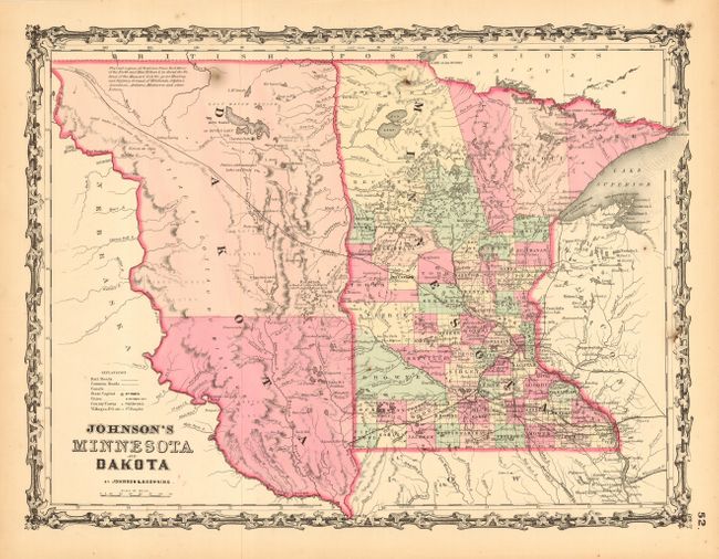
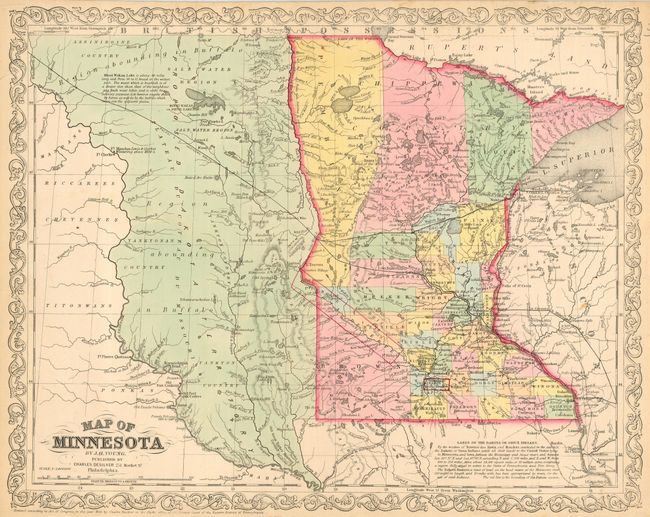
"[Lot of 2] Johnson's Minnesota and Dakota [and] Map of Minnesota by J.H. Young", Various

Subject: Minnesota & Dakota

Period: 1861

Publication:

Color: Hand Color

Size:
See Description
Download High Resolution Image
(or just click on image to launch the Zoom viewer)

The first is an attractive early map of Minnesota by Johnson & Browning, circa 1861, or only three years after Minnesota statehood. The newly formed Dakota Territory is a huge unorganized area with its western boundary along the Missouri River. Interesting notation locates vast prairies said to be "the great Hunting and Fighting Ground of Dakotah, Odjebwe, Assiniboin, Arikara, Minitarree and other Nations." Most of Dakota is labeled Yankton Country. Good detail throughout Minnesota including a few early railroads. A handsome map with the early strap work border.

The second map is the uncommon issue by Charles Desilver of Philadelphia. This earlier map has a large, unorganized region west of Minnesota to the Missouri River labeled the "Proposed Dakota Territory." A long notation at upper left describes Minni Wakan Lake. Another note at lower right describes in detail the "Lands of the Dakota or Sioux Indians." Surrounded by an attractive border. From the Illustrated Family Atlas, Philadelphia, 1861. (16.5 x 12.5")

References:

Condition: A

The former has an odd burn-like spot at top. The Desilver map has two marginal tears, closed on verso. Both still very good.

Estimate: $100 - $180

Sold for: $275

Closed on 3/6/2007

Archived