Catalog Archive
Auction 118, Lot 323

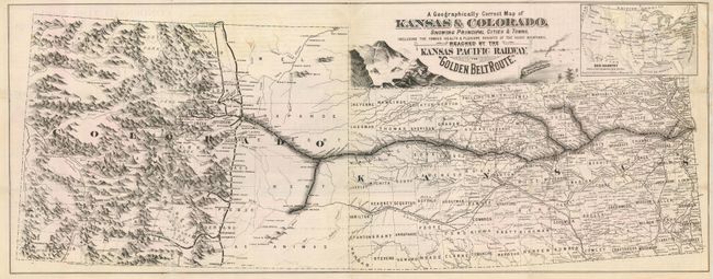
"A Geographically Correct Map of Kansas & Colorado, Showing Principal Cities & Towns…Reached by the Kansa Pacific Railway, the Golden Belt Route", Railroad Companies, (Various)
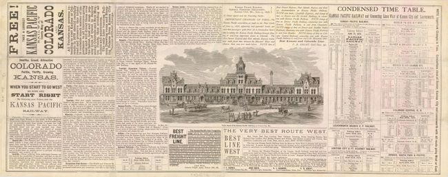
Subject: Colorado and Kansas

Period: 1878 (circa)

Publication:

Color: Black & White

Size:
25 x 9.8 inches
63.5 x 24.9 cm
Download High Resolution Image
(or just click on image to launch the Zoom viewer)

This is a very scarce, ephemeral railroad map illustrating the route from Kansas City to Denver along with several connecting routes. The map is particularly interesting for the graphic style used to delineate the mountains of Colorado with several mining camps and roads traced. The cartouche is decorated with a scene of the train approaching the Rocky Mountains. An inset map titled, Our Country with a Few Leading R.R. Lines Designed to show the Commercial Position of Kansas City, MO . On verso is the Condensed Time Table, advertisements for the route and a view of the Union Depot of the Kansas Pacific Railway, at Kansas City. Colorado is noted as "Healthy, Grand and Attractive" while Kansas is advertised as "Fertile, Thrifty and Growing." Not listed in Modelski and apparently not in the Library of Congress collection.

References:

Condition: B

Issued folding now pressed. Couple of abrasions in map affecting Rice and Lincoln Counties in Kansas. Couple of light tissue repairs on verso.

Estimate: $250 - $300

Sold for: $800

Closed on 3/6/2007

Archived