Catalog Archive
Auction 118, Lot 294

"Colton's Oregon, Washington, Idaho, Montana, and British Columbia", Colton, G.W. & C.B.

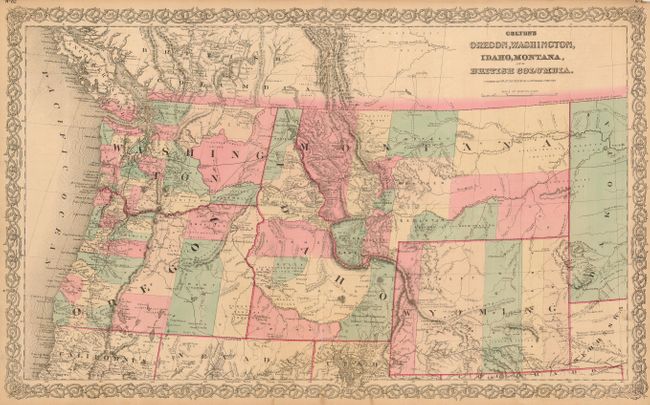
Subject: United States - Northwestern

Period: 1872 (circa)

Publication: General Atlas

Color: Hand Color

Size:
27 x 16.5 inches
68.6 x 41.9 cm
Download High Resolution Image
(or just click on image to launch the Zoom viewer)

Large double-page engraved map that shows the entire Northwest and extends to Dakota. The state and territory boundaries are as today. Filled with topographical and watershed information, but place names are scarce throughout much of the map. Wyoming has five counties, namely Uintah, Sweet Water, Carbon, Albany and Laramie. Idaho has only eight counties and Montana shows ten. Many mining regions are identified. The area west of the Cascade Mountains shows the most settlement with many towns and settlements. Likely published circa 1871-72 based on county development and the fact there is no mention of Yellowstone National Park. Victorian-style text and decorative scroll-type border. Text on verso.

References:

Condition: B

Fine impression and coloring with close margins, as issued. Margins toned with a few short tears, and fold separation in lower margin, closed on verso with archival tape. Map image is generally fine.

Estimate: $150 - $200

Sold for: $110

Closed on 3/6/2007

Archived